Most visitors to Raasay know about Calum’s Road, which he built almost single-handedly using simple tools over a period of years (1964 - 1975). It is a testament to his endurance and determination to save his community in the north part of Raasay, including on the islands of Fladda, Eilean Tighe and Rona, by improving communications and access to the south of the island. Numerous requests for a road had been submitted to the various authorities by Calum’s parents, their neighbours and later by Calum Macleod himself since the early 1920’s. All had failed, during which time, as he predicted and to his frustration, the number of people living in the north of Raasay had already dropped considerably.

As we drove along Calum’s Road, nearly 2 miles from Brochel Castle to his home in North Arnish, we were welcomed at the start by a fortuitous rainbow. We wondered how many rainbows Calum had seen as he laboured on the road, which he constructed with great skill along steep rocky slopes and over headlands, creating dry-stone dykes and culverts where necessary. Only twice did he ask for, and was granted, assistance from the Dept. of Agriculture to blast small sections of the route. He achieved all this in his ‘spare’ time, between his work as a crofter, fisherman and crewing the Rona Lighthouse Attending Boat that ferried both the keepers and their supplies to and fro Portree on Skye.


It seems a sad irony that the north of Raasay was refused the road that could have saved the community, since most of the population of Raasay had been moved there about 100 years previously. The then landowner, George Rainy, wanted the land in the south for a deer park and sheep farming. A deer fence and wall were built across the headland, reaching the sea at a small bay on Loch Arnish, to keep sheep and deer on one side and people on the other. It was only after WW2 that the people were able to return to the south where new opportunities and services were centred. So it really was for lack of a road that many people left the north. Calum must surely have taken some pleasure in breaking down the wall, which was about 2/3rds of the way to Arnish, to make his road above the wee bay, and using some of the stone to make sheep fanks (folds) for himself. When he finally finished the road the battle went on to persuade the authorities to surface it with bitumen and so make it serviceable for ordinary vehicles, a task that was not completed until 1982!

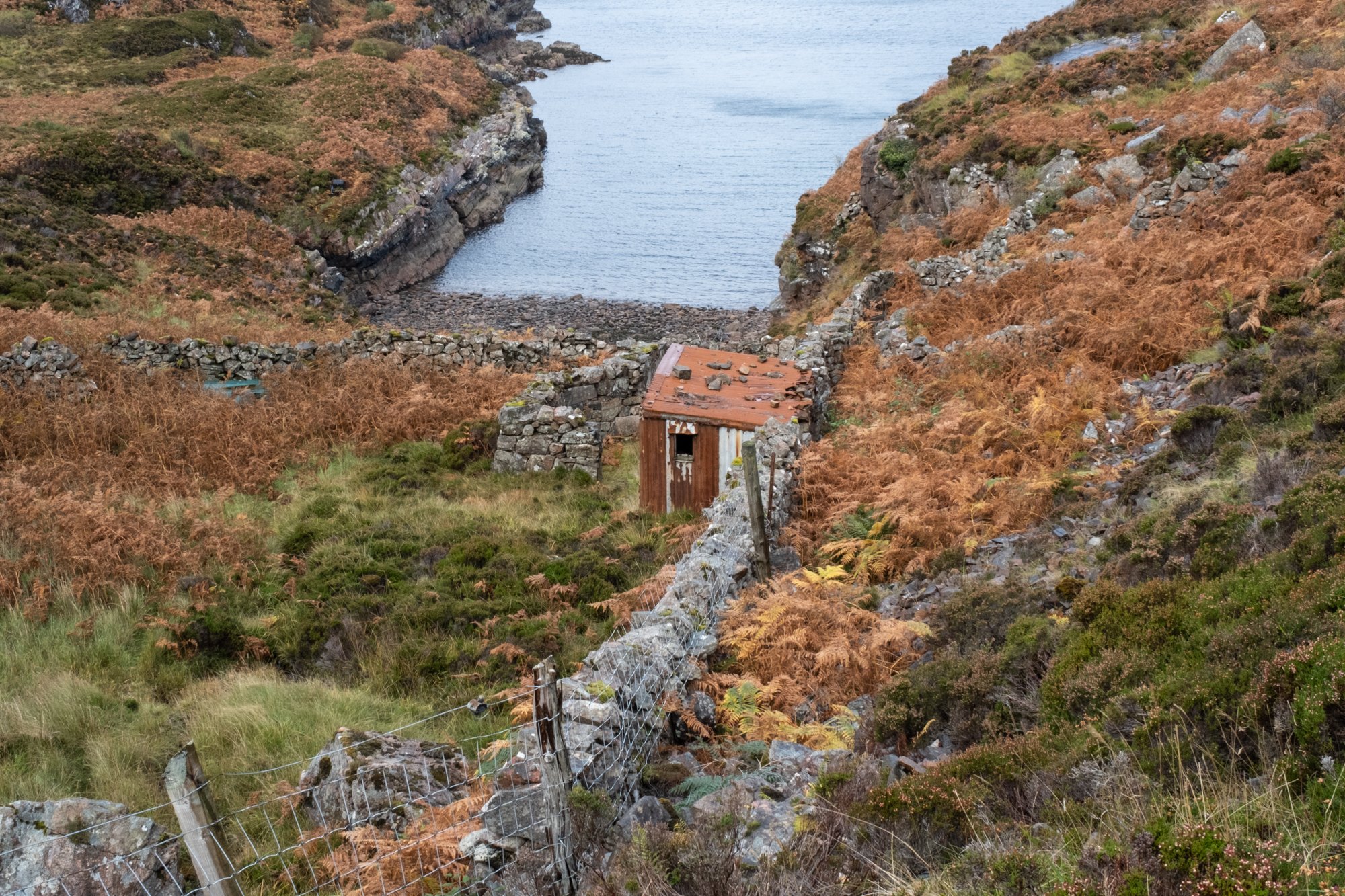
Fewer visitors may have heard of Calum’s other road. This was actually a footpath, constructed by Calum and his brother Charles between 1949 and 1952. It provided a better route for the residents of Fladda using the tidal crossing from the island to reach North Arnish and the rest of Raasay. In particular, the children of Fladda needed a quicker route to the schoolhouse at Torran. Often they missed schooling not only due to high tides covering the crossing but also due to the arduous nature of walking the existing route over the high moor. There had been requests for a bridge or causeway to be built which were consistently turned down as being too costly. Eventually the council agreed to pay Calum and his brother to make the road they had proposed around the coast. Their paved path is still there and was maintained in good condition until relatively recently. Unfortunately, although its surface is still intact in places, in other stretches it is barely discernible through the bracken or has become waterlogged. It remains a beautiful walk as it hugs the coastline, rising over headlands, running along gorges and through woodlands.


We stopped at a high point as the path rounded a headland and Fladda came into view. Here we were treated to a farewell rainbow over the now uninhabited island, before we turned back. The symbolism of hope is unavoidable, certainly in the context of Calum and his determination to carry on in the face of unsupportive authorities in the past.

Recommended reading;
Calum’s Road. Roger Hutchinson. 2008 Pub. Birlinn Ltd